History: Roads and Buildings
We are regularly asked what this neighbourhood looked like in the past, where the castle of Blaarthem used to be, etc.
The site https://www.topotijdreis.nl can help to gain insight. This land registry site provides 200 years of topographic maps. Zoom in on our neighbourhood (press LocateMebutton ⌖ ) and then choose the year.

Below are nice years to view. Remember that the topographic maps are always several years behind the changes in the landscape:
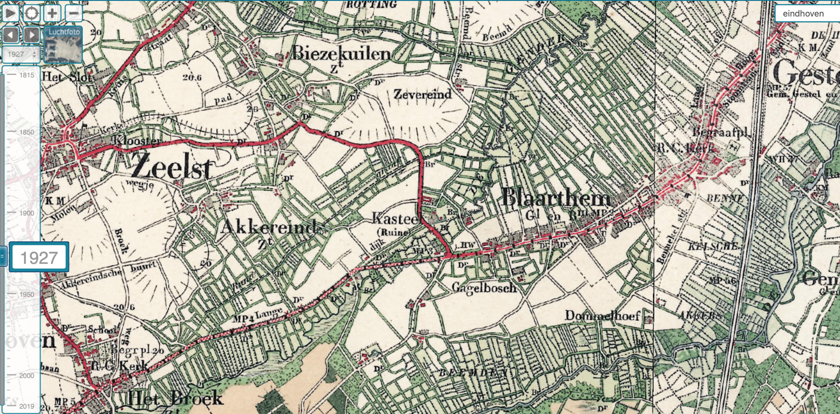
1927: here you can still see where the castle ruins once stood. Furthermore, some names are already recognizable.
1970: the inner ring of Eindhoven can be seen.
1972: the "Poot van Metz" (now A2 / N2) has been realized.
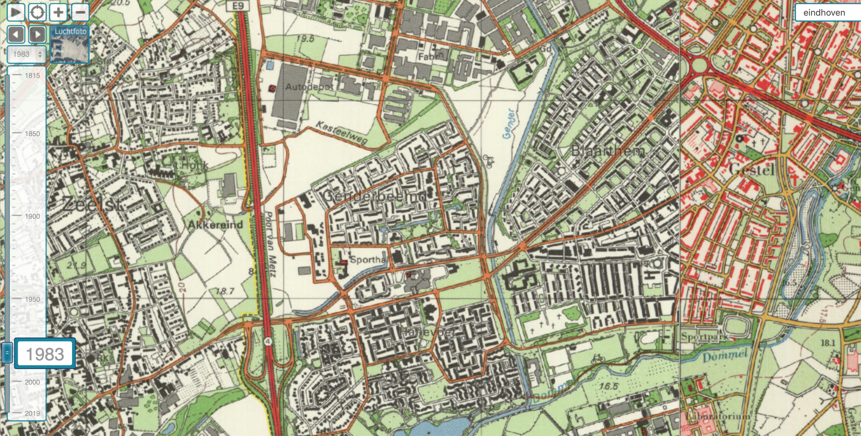
1983: Genderbeemd and Hanevoet in the Oud-Kasteel district (also known as "Gestelse Ontginning") are drawn. The "Vrijheidsstrijders" neighborhood (M.L.Kingstraat etc) has not yet been built.

1993: Vrijheidsstrijdersbuurt (M.L.Kingstraat and surroundings) is built. Nelson Mandela park does not exist yet, is still the old brick road ("Kasteelweg") with quicksand next to it.
2000: The cycle path through the Nelson Mandela park (does not have that name yet) was realized. The previously planned main road has been canceled. The Meerenakkerweg still ends near the A2.
2009: The Meerenakkerweg is extended to Veldhoven via the tunnel under the A2. The connection from Karel de Grotelaan to the A2 (entrance and exit in a northerly direction) has been changed.
2016: situation at the time of writing of this article: A2 is now A2/N2, Meerenakkerweg now has a connection to the N2, resulting in less traffic on Kasteellaan.